Map Service Publishing Based on QGIS Server
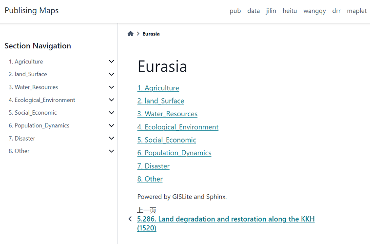
Use the static document website tool Sphinx to establish a map service publishing, and management tool to support the development of the project. For the convenience of management, a directory hierarchical self-derivation system is established using folder naming rules to form a secondary directory structure.
Mapping uses QGIS Desktop. Map services are published through QGIS Server. Obtain metadata content based on OGC related standards, including title, abstract, author, data source, date and time, etc.
The organization and construction of content use the Python documentation tool Sphinx. By adding the Leaflet plugin as a functional extension, this static website generator has the ability to visualize map displays.
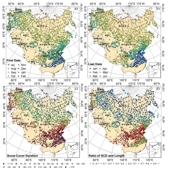
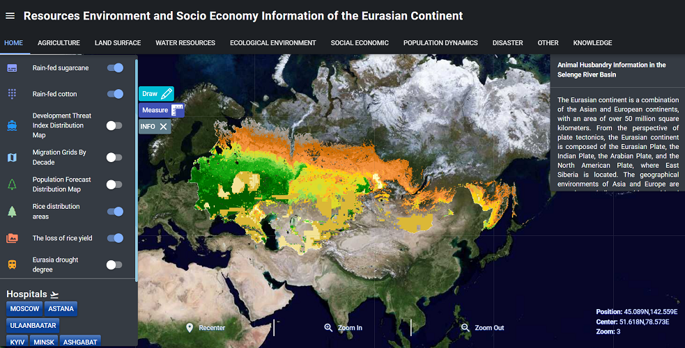
Eurasian Continental Geo-Spatial Data Visualization System
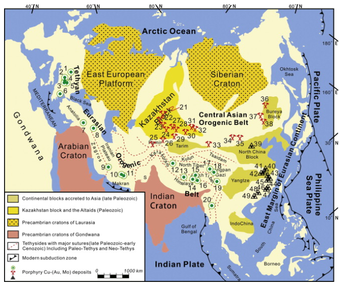
The Eurasian continent, also known as the Eurasian continent, is a combination of the Asian and European continents, with an area of over 50 million square kilometers. From the perspective of plate tectonics, the Eurasian continent is composed of the Eurasian Plate, the Indian Plate, the Arabian Plate, and the North American Plate, where East Siberia is located. The Eurasian continent can also be a nickname for the regions where the various member republics were located after the dissolution of the former Soviet Union. The geographical environments of Asia and Europe are complex and diverse, with transitional natural landscapes and distinctive economic and social development.
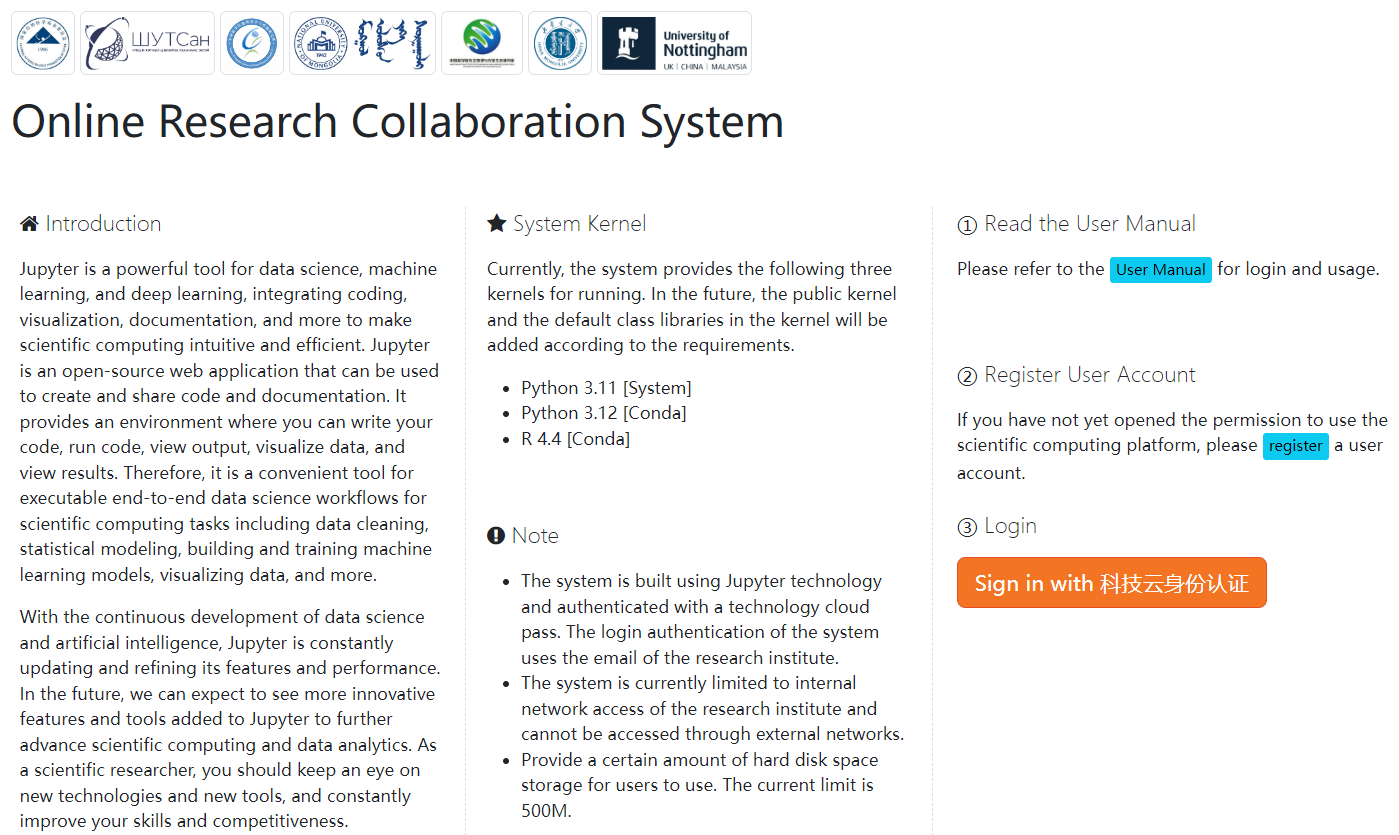
Online Research Collaboration System
Jupyter Notebook is a web-based interactive computing environment that can be used for data cleaning and transformation, statistical modeling, data visualization, machine learning, and more. For users of data analysis, it is suitable for data visualization. By adjusting code and parameters to update charts and visualization effects in real time, interactive data analysis and visualization operations can be carried out, which can help us better conduct data analysis and exploration.
Benefiting from the Debian GIS/Ubuntu GIS project, there are currently many open-source GIS software tools available in Linux systems, and many tools can be called by Python.
This platform is based on Python, open-source GIS, and open data to build an online collaborative computing environment, establish visualization tools, and complete interactive collaborative data analysis.
